PRC Association
The Forest
Discovery Center
Premium Map / Book
Order our Waterproof Pigeon River Country Map and Book.
Discovery Center Mailing List
Upcoming Events
Water Quality Connections
Date: June 27th (Saturday) Time: 1pm – 3pm Presenter: Sam Day Sam Day will introduce water quality programs administered by the Little Traverse Bay Bands of Odawa Indians. Take a […]
Big Wild Wednesday Youth Event
Date: July 15th (Wednesday) Time: 10am – 3pm Discovery the wonders of nature in the Pigeon River Forest. No charge for camps, must pre-register. Come to 1, 2, or all […]
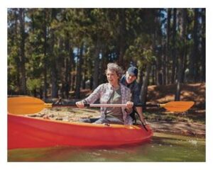
Canoeing and Kayaking
Be Prepared
 Canoeing on the river is for more experienced individuals. River conditions change frequently. Shifting log jams, brush, portages, and water levels are possible at any time.
The Sturgeon River frequently has fast water and is deep in many places.
Canoeing on the lakes are all experience levels.
Lakes

Pigeon River
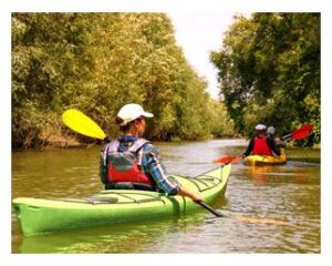
Areas to Access the River
- Pigeon Bridge
- Old Vanderbilt Rd.
- Elk Hill
- Ford Lake Rd.
- Tin Bridge Rd.
- Pine Grove
- Webb Rd.
- Pigeon River Rd.
Black River
Areas to Access the River
- Tin Shanty Rd.
- Town Corner Stairs
- Blue Lakes Rd.
- Clark Bridge
- Black River Rd.
- Black River Trail
Sturgeon River

Areas to Access the River
- Cornwell Grade Rd. (Fontinalis Rd.)
Recommended Trips

- Pigeon River
- Old Vanderbilt to Ford Lake Rd.
- Pine Grove to Pigeon River Rd.
- Pigeon Bridge to Pigeon River Rd. 10 hour trip with multiple portages north of Ford Lake Rd.
- Black River
- Relatively free passage between Town Corner stairs and Clark Bridge.
- Sturgeon River
- Relatively free passage north of Cornwell Grade Rd. (Fontinalis Rd.)
Discovery Center
Hours
Open the last weekend of April to the last weekend in October.
Fri: 10:00am - 4:00pm
Sat: 10:00am - 4:00pm
Sun: 12:00pm - 4:00pm
Contact Us
info@pigeonriverdiscoverycenter.org
![]()
![]()