PRC Association
The Forest
Discovery Center
Premium Map / Book
Order our Waterproof Pigeon River Country Map and Book.
Discovery Center Mailing List
Upcoming Events
Water Quality Connections
Date: June 27th (Saturday) Time: 1pm – 3pm Presenter: Sam Day Sam Day will introduce water quality programs administered by the Little Traverse Bay Bands of Odawa Indians. Take a […]
Big Wild Wednesday Youth Event
Date: July 15th (Wednesday) Time: 10am – 3pm Discovery the wonders of nature in the Pigeon River Forest. No charge for camps, must pre-register. Come to 1, 2, or all […]
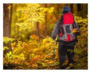
Trails
You can hike anywhere in the forest boundaries (unless specifically prohibited by DNR rule or state law). There are many marked trails ranging from less than a mile long to over 80 miles long. Many of the trails are designed as “loops” to bring you back to your starting location and vehicle.
Pathways
 Towerman’s Watch Interpretive Pathway: (10’N 27’W) Starting at the PRC headquarters with two loops of 3.3 or 3.9 miles, this pathway takes you through towering pines and over rolling hills. Highlights include the Witness Tree, a beaver pond, the P.S. Lovejoy Monument and a loop to the former Pigeon River Middle fire tower.
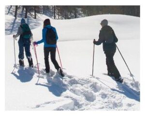
Shingle Mill Pathway: (10’N 28’W) With five loops ranging from ¾ to 11 miles long, this is the PRC’s most popular pathway. Visitors hike and bicycle in the summer or cross country ski and snowshoe in the winter. From the Pigeon Bridge Campground, this pathway snakes along the swift-flowing Pigeon River for several miles before climbing into the highlands overlooking the river valley. It traverses a 1,700-foot-long boardwalk through a cedar swamp.
 Inspiration Point Pathway: (13’N 24’W) This 1/4 mile pathway near the intersection of Osmun and Clark Bridge roads runs through remnants of the 1930s CCC camp to a scenic overlook. The view includes a variety of forest cover types, a glimpse of Cornwall Flooding, and a large open area, part of which is maintained by DNR to enhance elk and deer habitat. Visitors may debate whether the high ground they are seeing is Pickerel Lake Rd 6 miles away, or Peanut Hill Rd more than 10 miles away. Cornwall Flooding is a 161-acre impoundment behind a dam erected with federal and state funds in 1966 to provide a “trout lake,” now populated by bass, bluegill, and other panfish, on Cornwall Creek, which feeds into the Pigeon River.
 Pickerel Lake Pathway: (10’N 32’W) This 2-mile pathway loops around Pickerel Lake from its trailhead at the boat launch next to the campground. The CCC made Pickerel Lake a favorite swimming spot by creating a sandy swimming area.
Sinkholes Pathway: (15’N 10’W) Michigan’s most visible sinkholes are along this 2½-mile trail that loops around five such depressions, some more than 100 feet deep. Gypsum deposits about 900 feet down that dissolve cause a collapse that creates sinkholes. Those along the Sinkholes Pathway are dry, while others nearby, like Shoepac Lake and Tomahawk Lake, [also Ford (11’N 27’W) and Section 4 (11N 27W) Lakes over on the Shingle Mill Pathway as well as others near them] are filled with water. Some 2,600 acres of sinkhole area around the Sinkholes Pathway are closed to all motorized vehicles, providing a setting of forest solitude. These sinkholes are part of a karst system extending eastward to Lake Huron. Learn more about our Sinkholes.
 North Spur Shore-to-Shore Riding-Hiking Trail: (crosses HCP at 18’N 25’W and at 8’N 23’W) The North Spur horse trail provides horseback riding and hiking. It is part of Michigan’s 355-mile Shore-to-Shore Riding-Hiking Trail system designated for horse riding and hiking.
Clear Lake / Jackson Lake Pathway: (7N 10W) This pathway runs through the Atlanta Management Unit between Clear Lake State Park and Jackson Lake Campground. Total round trip is about 7½ miles with opportunities to take shorter loops. Part of it overlaps the HCP.
 Green Timbers Pathway: Scenic vistas, prime wildlife habitat and eight miles of Sturgeon River (10’N 34’W) frontage dominate this 6,300-acre tract on the west side of the PRC, known as Green Timbers. There is a network of management roads behind gates that allow access to the interior of the property, but on foot only. Its trails are unmarked, so visitors are advised to carry compass and GPS or Green Timbers Trail Map. The trails range from two-tracks to barely visible, overgrown paths mainly used by elk and deer. Mountain bikes, horses, other motorized vehicles are not allowed in the Green Timbers unit. The easiest route to follow is the trail from the Sturgeon Valley Road parking area to Green Timbers Cabin, a trek of 2.3 miles. Parking is also available from a trailhead on Bush Road, which is not plowed in the winter making this only seasonally accessible.
High Country Pathway
 The High Country Pathway (HCP), 80 miles long, offers one of the Lower Peninsula’s best near-wilderness experiences. It passes through habitats ranging from rolling hardwood forests and meadows to low-lying wetlands. It was designed to provide the backpacker with roughly one week of outdoor adventure. Here is a description and highlights for each section:
Sturgeon Valley Rd. to Osmun Rd (17½ miles)
Heading north from the trailhead parking lot (9’N 28’W) on Sturgeon Valley Rd., you enter the Pigeon Bridge Campground on the east side of the Pigeon River. Here the HCP joins the Shingle Mill Pathway for the next 6.7 miles; with scenic overlooks.
Pigeon River Country Headquarters: (10’N 27’W) The log structure built by the CCC in 1934-35 burned in 1985. Michigan Civilian Conservation Corps youths helped rebuild it with red pine logs from within half a mile of the site. This PRC headquarters building was dedicated in 1991. The nearby former residence of the PRC manager sat vacant for a decade until the Pigeon River Country Association began outfitting it in 2015 as a discovery center. Buildings at this site at one time housed a state fish research station, work crews, and Michigan’s first conservation school.
 Pigeon River Campground: (10’N 26’W) A good place to overnight. It is on the south bank of the Pigeon River, about three miles from the trailhead on Sturgeon Valley Rd. The pathway follows the campground road and crosses the Pigeon River on the east end of the campground. Near the Devil’s Soup Bowl Lake, the HCP splits from the Shingle Mill Pathway and goes north to Pine Grove Campground. Along the way, the edge of a ridge overlooks a marsh, beaver pond, and hardwood stand at Bird Tally Creek.
Pine Grove Campground: (15’N 27’W) Surrounded by white, red and jack pines, this is one of the PRC’s most secluded campgrounds. Located on the north bank of the Pigeon River, this is an excellent spot for camping, hiking, fishing, or relaxing. Can you identify the pines? Some hints: red pine has reddish flaky bark, a tall straight trunk, and long needles in clusters of two; jack pine has black flaky bark and shorter needles in clusters of two; white pine, the “State Tree,” has ridged, gray-black bark with light feathery needles growing in clusters of five. North of the campground, surface sediments are glacial outwash sand and gravel and post-glacial alluvium and coarse-textured glacial till, about 200-400 feet thick.
Northern Hardwood Management: (17’N 26’W) Just north of Webb Rd., the HCP passes through a hardwood forest selectively cut in 2004 to provide proper spacing for growth and reproduction of the remaining trees. Harvesting every 15 to 20 years encourages rapid growth and partially mimics natural processes. The results are a variety of shade-tolerant species of different sizes and ages, providing a forest structurally and compositionally diverse. Northern hardwood stands contain beech trees with claw marks on the silver-barked trunks from bears climbing to eat beechnuts in the fall. The white ash here were recently killed by emerald ash borers, an invasive insect, and the beech are being attacked by beech bark disease.
 Osmun Rd. (18’N 25’W) to Shoepac Lk Campground (20½ miles)
Here the HCP passes through some of the most remote and wild areas of the PRC. Numerous lowland conifer swamps are interspersed with rolling terrain containing pine, aspen, and some hardwood stands.
McLavey Lake: (17’N 21’W) A ½ mile spur north on the HCP leads to McLavey Lake, surrounded by white birch trees blending into cedar-balsam swamps. Good access to the shallow, sandy-bottomed lake makes this is an inviting place to camp.
Duby Lake: The ¼ mile spur pathway out to Duby Lake traverses the only high ground to this dying lake. The lake’s boggy shoreline is surrounded by dead snags, tag alder, and blueberry thickets that blend into the surrounding cedar-balsam swamps. There are good camping sites in this area. At night, the area comes alive with the sounds of nature. Farther on is a trail shelter just west of Canada Creek.
Shoepac Lk Campground to Clear Lake / Jackson Lake Pathway (13¾ miles)
Terrain in this section is mostly dry with rolling hills and a few steep climbs.
Shoepac Lake: (14’N 10’W) The lake is a sinkhole, about 95 feet deep, in an area of sinkholes. A dry sinkhole, only a few hundred feet east of Shoepac Lake, is about 140 feet deep, or about 45 feet below the bottom of Shoepac Lake – a very unusual situation. Clay present at Shoepac keeps water in the lake, while the dry sinkholes are in mostly sandy soils that allow water to drain away.
 Tomahawk Creek Flooding: (13’N 10’W) This flooding, created to increase the quality of fish and wildlife habitat, provides a peaceful setting for viewing nesting loons and osprey. Bald eagles nest nearby. Water levels in the flooding fluctuate seasonally, more so than in nearby lakes. This often exposes wide sandy shorelines during the drier summer months, which are used by wading birds and migrating shorebirds. A variety of woodpeckers and tree swallows gather on the dead snags at the flooding. Habitat management for elk and deer and other forest wildlife on state forest lands in the area has created different forest age classes and many grassy openings. This diversity attracts a wider variety of breeding songbird species.
The flooding lies within the Clear Lake Kirtland’s warbler management area. Jack pine stands in it are managed for the endangered Kirtland’s warbler and the dozens of other wildlife species that benefit from this special ecosystem. Virtually the entire world population, now about 2,300 pairs of Kirtland’s warblers, nest in twelve counties in Michigan’s northern Lower Peninsula, six counties in the Upper Peninsula, and since 2007 also in Wisconsin and Ontario. Openings of 100+ acres are created to provide young jack pine needed for Kirtland’s warbler nesting. A wide diversity of songbirds are found in the different-aged jack pine and oak areas resulting from this management, and in turn, offer excellent wildlife viewing.
Clear Lake / Jackson Lake Pathway (7’N 10’W) to Camp 30 Rd. (14 miles)
This section starts out flat to gently rolling, becoming hilly by the time you reach Rattlesnake Hill. Forest types range from jack pine barrens to northern hardwoods, interspersed with open meadows. See the Clear Lake / Jackson Lake Pathway entry below.
Rattlesnake Hill: (4’N 16’W) Rattlesnake Hill is a kame moraine formed from debris trapped in a crevasse during the Wisconsin glaciation and then deposited by glacial melting. The strenuous 200’ climb to the top of Rattlesnake Hill rewards you with a tremendous panoramic view. At 1,230’ above sea level, this is the highest point on the HCP.
 Camp 30 Rd. (5’N 19’W) to Sturgeon Valley Rd. (14½ miles)
Much of this section traverses high rolling hills covered with northern hardwood, oak, pine, and aspen stands, and has a few scenic overlooks.
Tubbs Creek: (4’N 22’W) An excellent example of the many wetlands throughout the region. Acre for acre, wetlands produce more wildlife and plants than any other Michigan habitat type. Conifer swamps are especially rich and provide habitat for amphibians, songbirds, reptiles, and mammals seeking food and dense cover. Trees near Tubbs Creek include white cedar, balsam fir, and black spruce. The pathway enters the wetland from pine forest leading into lowland deciduous forest. It exits into stands of aspen and jack pine.
Aspen Clear Cut: Just south of the footbridge crossing the Black River near Chandler Dam Rd (7’N 24’W), this aspen stand was clearcut in 2004. Aspen, sometimes called “popple,” regenerates best after it is clearcut by sending up thousands of shoots from the root system. The shoots are food for many animals and are a favorite of elk. Young stands of aspen provide favorable habitat for many species such as oven birds, woodcock, ruffed grouse, snowshoe hare, deer, and elk.
Biking
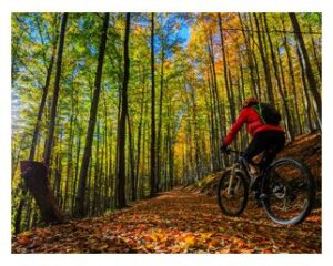 Biking is allowed on all vehicle roads, and the following pathways:
On state forest land on the map that is outside the Pigeon River Forest, biking is not restricted.
Mountain bike associations promote safe riding and provide basic guidelines:
- Yield the right of way to other trail users.
- Control your speed and pass with care.
- Give warning well in advance when overtaking horses and hikers. If necessary, stand to one side to let oncoming horses go by and talk to riders as they pass.
- Stay on designated roads and trails.
- Don’t disturb wildlife or livestock.
- Pack out all litter.
- Respect the land – avoid muddy trails, excessive braking, or crosscutting switchbacks.
- Be prepared to walk or carry your bike, especially on boardwalks.
- Know local rules.
- Plan ahead.
- When possible, ride with a partner. Always leave your itinerary with someone.
Pathway User Code Of Ethics
 Respect the solitude of others. Let nature’s sounds prevail. Travel in small groups. Do not engage in activities or create situations that disturb others.
- For safety, travel with a friend. Always leave your itinerary with someone.
- Carry a map and compass in addition to GPS.
- Drinking water and toilets are available at the campgrounds. Do not drink from streams or springs without first purifying. When toileting outside of a campground, dig a hole no more than 6 – 8 inches deep to stay within the “biological disposer” layer of the soil, and cover after use.
- Extinguish all fires carefully.
- Pack out all litter.
- Plan for variable weather.
- Carry insect repellent in warm months.
- Keep pets under control at all times.
- Do not use soap in rivers or lakes and dispose of gray water at least 100 feet from surface water.
- Camp at least 100 feet from water.
Discovery Center
Hours
Open the last weekend of April to the last weekend in October.
Fri: 10:00am - 4:00pm
Sat: 10:00am - 4:00pm
Sun: 12:00pm - 4:00pm
Contact Us
info@pigeonriverdiscoverycenter.org
![]()
![]()